Geomatic technology transferred to animal health services in southern Africa - GeosAf
Last update: 19 January 2018
Dates 2014-2017
Get the GeosAf Leaflet
Global objectives
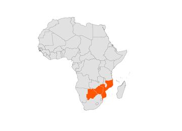
- Contribute to the reduction of rural poverty by improving livestock production through the transfer of Science, Technology and Innovative tools in the animal health sectors of Botswana, Mozambique and Zimbabwe.
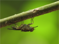
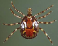
- Improve surveillance and control of vectors (ticks and tsetse flies) and the diseases they transmit by the capacitation of veterinary services in geomatics tools in Botswana, Mozambique, Zimbabwe and neighbouring countries.
- Foster communication, transfer of knowledge and technology between research institutions and governmental services and between animal health actors (public & private) at the international level in southern Africa.
Specific objective
Supporting the adoption of geomatics technologies by central and local veterinary services to improve vector-borne disease management in Botswana, Mozambique, Zimbabwe and SADC level.
Estimated results
- Geomatics technologies, data and information gathering and production technologies are identified; local, national and regional action plans are formulated by multi-disciplinary scientific and technical fora.
- Central and local veterinary services are capacitated in geomatics and data and information technologies within Southern Africa.
- Geomatics technologies are used by the veterinary services in the three countries to produce vector distribution and disease risk maps.
- Products generated by geomatics technologies applied to vector and vector-borne diseases are transferred to decision makers to improve disease surveillance and control from local to regional levels and disseminated towards farmers.
Impact of the action
The action will have an important impact in term of capacity building of governmental services, increase of epidemiological knowledge and improve livestock production with benefit at local and national economic and political levels.
Support and capacity building of veterinary services in geomatic technologies enable a better understanding of the epidemiology of vector borne diseases. The project targets to train 20 veterinary officers from the 3 countries.
The study of the distribution and determinants of vectors and vector-borne diseases, and the relationships between prevalence of target diseases and environmental characteristics will be better understood. This knowledge will improve the control of vectors and will inform the eradication programme of tsetse flies‟ populations in the countries targeted by the action (a successful tsetse eradication program allowed to clear the Okavango area, Botswana) and a reduction of the TBDs prevalence.
Vector control is based on two main strategies: the control of vector densities in the long term (below the transmission threshold) or elimination of vector populations. An accurately vector distribution map, thus provides crucial data for the vector control which will have both a direct economic impact on the control (targeted control will have a better cost-effectiveness) and an indirect economic impact with a reduction in the loss due to death of livestock or reduction in the draught power.
TBDs are responsible for causing over 65% of the total cattle mortality in Zimbabwe and over 48% of the total domestic ruminant mortality in Botswana. By improving control of vector-borne diseases, this project hopes to reduce mortality rates and thus contribute to improving livestock production and contribute to the reduction of rural poverty.
Information provided by the project will be transferred to policy makers who can promote an integrated strategic plan to control vector-borne diseases. Similarly, their awareness of the interests of geomatic technologies allows a transfer of these tools to other development domains of interest.
Last update: 19 January 2018


